Showing posts with label National Parks. Show all posts

Wednesday, June 7, 2017

Lençóis Maranhenses - When to go

Lençóis Maranhenses - When to go


Lençóis Maranhenses - dunes and blue lagoons at the northeast of Brazil

Lençóis Maranhenses - dunes and blue lagoons at the northeast of Brazil


As the Lençóis are very close to the Ecuator line, weather is always hot or warm in this region of Brazil, all year round. It is very windy, so it isn´t an unbearable hot. Sea water is also warm. 

Rains are expected to fall from january to may, so in may the lagoons will reach its maximum water level. Up to the beggining of september, fun is granted, if rains fell substantially during the previous months. 

So, the ends of may untill the beggining of september are the best time to go, since sunny days are expected and the lagoons are suposed to be full. 


Lençóis Maranhenses - dunes and blue lagoons at the northeast of Brazil

Lençóis Maranhenses - dunes and blue lagoons at the northeast of Brazil


November is supposed to be the month when the level of the lagoons is lower, but it depends on rain levels, which can vary. 

However, climate change is obviously modifiyng rainfall in Brazil. Unexpected weather can happen, and nowadays nobody can grant a rainfall period or a dry season in advance. 


Sunday, June 4, 2017

LENÇÓIS MARANHENSES


LENÇÓIS MARANHENSES

Getting there


Lençóis Maranhenses - dunes and blue lagoons at the northeast of Brazil


I decided to split the post and repost our tour at Lençóis Maranhenses National Park. Also, I put the marker Lençóis Maranhenses at the scroolbar to the right.

Lençóis Maranhenses - dunes and blue lagoons at the northeast of Brazil

  The closest city to the national park is Barreirinhas, where there are many hotels. It is just a base-village to get to the dunes, so its advisable to take money and all you need, speacially sunblock and mosquito repellent. 


Lençóis Maranhenses - dunes and blue lagoons at the northeast of Brazil

Barreirinhas is 3 and a half hours from the capital of the state of Maranhão, São Luiz do Maranhão (Saint Louis). The SLZ airport is mainly a domestic airport, so to get to Maranhão you´ll probably need a conection in São Paulo, Rio, Brasília or Manaus. There are tour operators which takes tourists from SLZ airport to Barreirinhas, but renting a car can also be a good idea, with a GPS - and caution in the road to Barreirinhas, since it crosses many small villages with many speed-bumps. 

Another option is to come from the state of Ceará and its capital Fortaleza, although it is farther and you would have to cross a small part of the state of Piauí. In this case, trip would be very beautifull and at least two other stops should be added: Jericoacora, the most famous beach in Ceará state, and the "Delta do Parnaíba", the river Parnaíba mouth, in a delta shape. 

Monday, September 14, 2015

Chapada dos Veadeiros 9 - Abyss and Window waterfalls

Chapada dos Veadeiros 9
 Abyss Waterfall and the window stone


(Cachoeiras do Abismo e da Janela)

This is the harder track of all I´ve done in the Chapada dos Veadeiros. It starts in a vistapoint over a hill, about 2 km away from the village of São Jorge. Atop this hill people leave their cars to start the trail, and it is common to see people camping there. 


This track demands really good physicall preparation. First, trackers must get down this hill towards an environmentally protected area, though private. There´s a guy charging a small fee for entering the area. The track goes by dense jungle and also cerrado fields, taking about half an hour to arrive atop the Abyss Cascade (Cachoeira do Abismo). 


The name is exactly what it means: an abyss among the rocks, from where trackers must get down to a valley, to later climb up again another mountain. The abyss cascade only exists during the rainy season, as it is part of an intermittent river. 

But stoping there to take a bath and grab some water is precious, specially when you come almost dead in the back journey. Many tourists don´t go on, and stay at the Abyss Cascade waiting their most courageous friends who decided do to go on. Enjoying this view isn´t bad:

The view from the Cachoeira do Abismo - Abyss Waterfall in Chapada dos Veadeiros National Park

If you are among the courageous, know that you didn´t reach half way. Getting down to the valley is easy, though one must be cautions, since the mountain is very sharp. At some places there are stairs and wooden handrail to help. 

Once in the valley, a short walk leads to the rocks and stairs leading atop the next mountain, and this is very hard climb, because this mountain is also very sharp. 

Once atop, the view is superb. It seems all the Chapada is under your feet, and you can see the huge Jump Waterfall quite small many meters under you.


But if you have a good guide, he can take you to the window stone, to see the Salto do Rio Preto Waterfall, which is nothing more, nothing less than the very "Jump of Rio Preto river" Waterfall inside the National Park. 


Enjoy this incredible view while you take a breath to do all the way back!


Friday, September 11, 2015

Chapada dos Veadeiros 7 - The Moonvalley

Chapada dos Veadeiros (7)
 The Moonvalley

Rocks at the moonvalley, at Chapada dos Veadeiros in Brazil
(O vale da Lua)

In a private area located in the same road linking Alto Paraíso de Goiás with São Jorge´s village it is located the moonvalley, known in portuguese as Vale da Lua

To get there, see the previou post Chapada dos Veadeiros 2 - Getting to the Chapada dos Veadeiros National Park (published in september 6, 2015):


Once in this road, search for the signs for Vale da Lua. It is needed to ride about 10 minutes in a dirty road to get to the main entrance of the moonvalley. Although it is not paved, road conditions were ok last year, but maybe they can get bad during rainy season (october to march). Entrance is charged, but it is not expensive. If you don´t want to do it with your car, you can call a guide who can provide transportation from your hotel.

Vale da Lua
Landscape in the trail to the moonvalley, at Chapada dos Veadeiros in Brazil
From moonvalley´s entrance to the rock, it takes a small walk of 5 minutes. The place consists in a very old grey rock carved by a river, forming a very curious landscape. The rock seems a cheese with holes made by the water stream. 

Rocks at the moonvalley, at Chapada dos Veadeiros in Brazil
Be cautions because this rock is very, very slippery, even more with water. The water stream inside the rock is very strong, so it is forbidden to swim in some parts of the rock. Signs indicate the natural swimming pool´s limits.  

One natural swimming pool and rocks at the moonvalley, at Chapada dos Veadeiros in Brazil

Water in this place is very clear. I don´t think you need to go with a guide, since you obey all the signs and rules, and stay in the allowed areas for tourists.


Rocks at the moonvalley, at Chapada dos Veadeiros in Brazil


Rocks at the moonvalley, at Chapada dos Veadeiros in Brazil


Rocks at the moonvalley, at Chapada dos Veadeiros in Brazil


Rocks at the moonvalley, at Chapada dos Veadeiros in Brazil


Rocks at the moonvalley, at Chapada dos Veadeiros in Brazil


Thursday, September 10, 2015

Chapada dos Veadeiros 6 - The water jumps track

Chapada dos Veadeiros (6) 
The Water Jumps´ Track
Salto do Rio Preto

The Jump of Rio Preto, inside the Chapada dos Veadeiros´National Park

The Water Jump´s Track, my free translation to Trilha dos Saltos, is the most thrilling one inside the National Park. This 11 km (8 miles) track leads to the highest waterfall inside the park (800m), allowing a view from the top of the waterfall to its bottom, where a lagoon is formed. 

First you´ll walk through the cerrado, close to the Rio Preto´s valley. The plants, the crystals and the rocks are amazing, as well the crystal clear water springing from the rocks. 

Walking in the Cerrado, in the direction of the Salto do Rio Preto waterfall, inside Chapada dos Veadeiros´National Park

After one hour walk, you start hearing the waterfall´s noise, and soon you´ll see the abyss, where there´s a rustic stairway. The abyss gives you an incredible view of the jungle inside the Park, an almost untouched place where people just get by walking a lot on those tracks, leaving all signs of civilization behind. 


Some steps down and you can take pictures of the waterfall from a vistapoint:


Cachoeira do Salto do Rio Preto - The Jump of Rio Preto´s waterfall


Cachoeira do Salto do Rio Preto - The Jump of Rio Preto´s waterfall
 The stairway down to the lagoon is rustic and, of course, surrounded by the jungle, so it is not an easy ride. It demands good physical preparation to get down and climb again. Once you reach the lagoon, you can have a relaxing bath, though stones are very sharp there, what makes baths a bit difficult. Be mindful of snackes and slippery rocks, one can get hurt. 


Cachoeira do Salto do Rio Preto - The Jump of Rio Preto´s waterfall


Wednesday, September 9, 2015

Chapada dos Veadeiros 5 - The Canions´ Track

Chapada dos Veadeiros (5) - The Canions´ Track

(The Rio Preto and its canions, forming natural swimming pools, inside Chapada dos Veadeiros´National Park) 

The Canions´Track is a 12 km (about 8 miles) track inside the National Park, leading to small waterfalls that forms natural swimming pools. 

When arriving in the National Park, follow the "Trilha dos Canions" signs. They divided the tracks acoording to arrows, the yellow and the red ones, so one must follow the respective arrow, though I insist, once again, to hire a guide. 

Don´t think you´re going to see a Grand Canion scenery, and I suppose the track got this name due to the number of rocks found in the track and in its waterfalls, not exactly for beeing a deep canion. 

Landscape is very beautiful, as these waterfalls are inside the Black River´s valley (Rio Preto), which crosses the National Park and forms those waterfalls. 

(The Rio Preto and its canions, forming natural swimming pools, inside Chapada dos Veadeiros´National Park) 


During the rainy season (from october to march), it is advisable to be very alert about a rapid increase on water levels, due to strong rains elsewhere in the river´s basin. Though it may not be raining in the park, a strong rain elsewhere can make water levels increase too fast - and this is another reason to hire a guide, because the know the region and its dangers. 


(The elephant stone, in the way to the canions)
  
(The Rio Preto and its canions, forming natural swimming pools, inside Chapada dos Veadeiros´National Park)


Tuesday, September 8, 2015

Chapada dos Veadeiros 4 - the National Park

Chapada dos Veadeiros 4 - the National Park

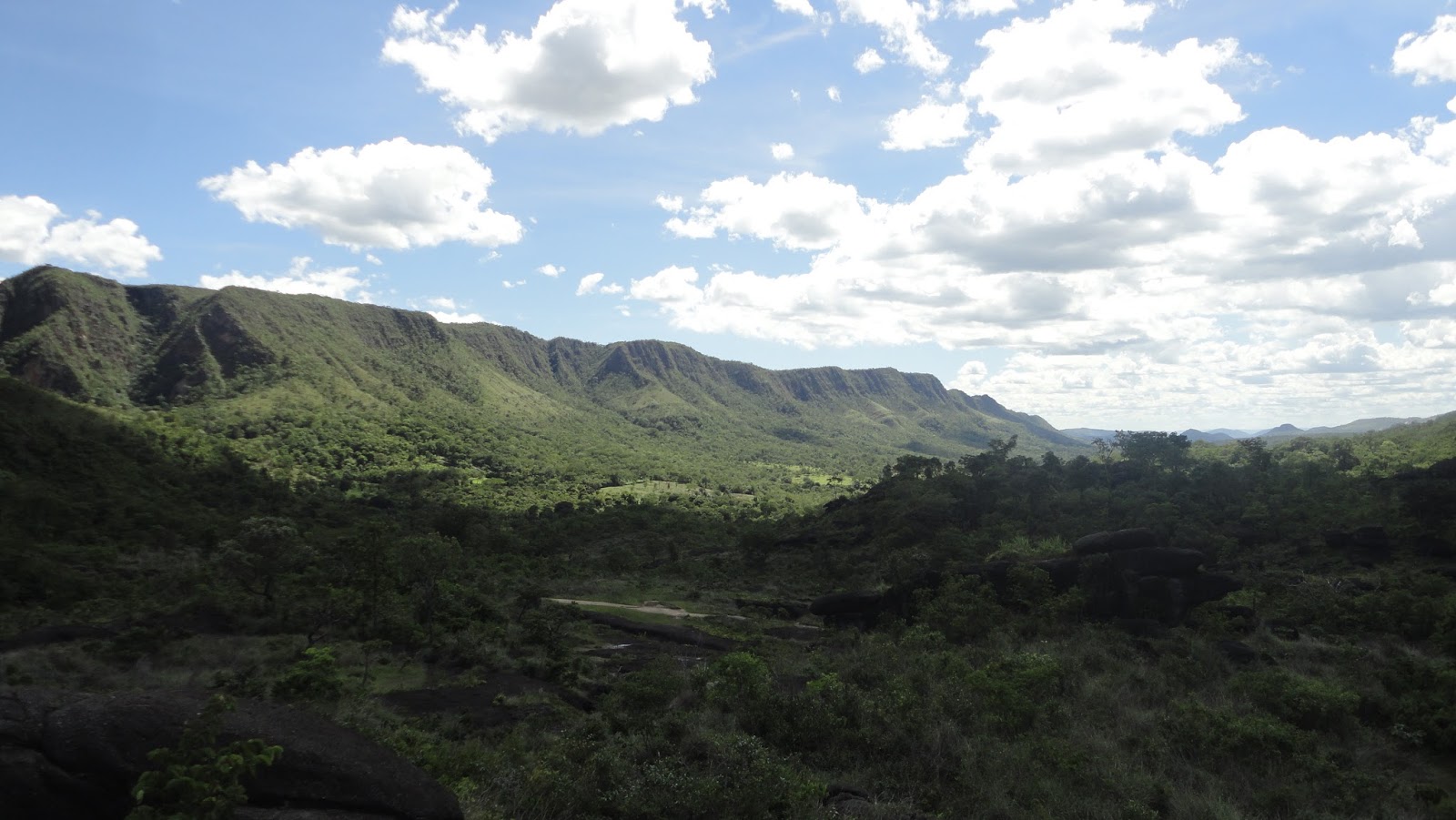
The majestic view of the Chapada dos Veadeiros´National Park

Once you´ve reached São Jorge village, you´re close to the main entrance of the National Park. Visits are allowed during daytime, except if you hire a guide for the biggest track, which takes more than one day and will demand you sleep inside the park.

Nowadays hiring a guide for the one-day tracks isn´t mandatory, but it is highly recommended. Tracks may be tough among stones and bushes, and twisting the foot alone in one of them would be a big problem if you don´t have someone to help. 

The majestic view of the Chapada dos Veadeiros´National Park

There are four tracks recommended by the Parks´administration (site only in portughese: http://www.icmbio.gov.br/parnachapadadosveadeiros/guia-do-visitante.html)

1) one very easy, of 800m, the Siriema track; 

2) the Sete Quedas Track, of 23km, which takes 2 to 3 days, 

3) the Saltos Track (11km to go and come back), which leads to the highest waterfalls and 

4) the Canions Track (12 km, to go and come back), which leads to smaller waterfalls, but better to take a bath. 


The Saltos track is quite hard, since you start over the top of the waterfall, so you have to get down then climb again, in the way back. Also, the track is really in the middle of the jungle. 


The Canions Track, though a bit longer, is easier because there aren´t so many ups-and-downs, and eventually you walk on dirty roads, so you won´t be hit all the time by the bushes and you won´t have to worry so much about....snackes. 

It is very important to carry water in canteens or squeezes; you won´t have enough water all the way along the tracks, so you´ll have to grab some water in the rivers. Don´t worry, the water is crystal clear. If you don´t want to drink river water, you´ll have to carry lots of squeezes and canteens, making the hike much harder.


Sunblock and (very) comfortable sneackers, preferably those which protects the anckle - or, simply, boots -  are very recommended too. As the tracks take hours, taking sandwiches and snacks are very advisable, you won´t find a place to eat inside the park. 

The Park allows entrances just untill midday, and exit is mandatory by 6pm. 


The majestic view of the Chapada dos Veadeiros´National Park


SP GLBT Pride - the best places to dance

São Paulo´s LGBT Pride - the best parties and discos to dance Avenida Paulista, where every year, at june, the São Paulo gay pride i...